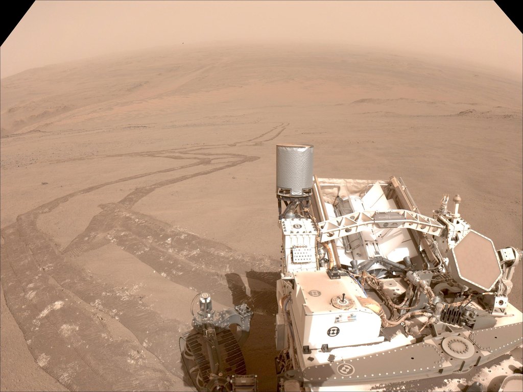
Tracks Tell Tale of Perseverance's Crater Rim Climb
One of the navigation cameras aboard NASA's Perseverance captured this image of the tracks made by the rover during its climb up the rim of Jezero Crater on Oct. 11, 2024, the 1,295th Martian day, or sol, of the mission.
The rover's tracks, seen disappearing into the distance, have churned up the regolith (broken rock and sand) on the surface, indicating high slip. The edges of the tracks are not straight or smooth, which indicates cross-track sliding during the drive. On less slippery terrain, the tracks have well defined lines from the grousers on the rover wheels.
The distant river channel seen at the upper left of image is Neretva Vallis, which fed Jezero Crater with fresh water billions of years ago.
A key objective for Perseverance's mission on Mars is astrobiology, including the search for signs of ancient microbial life. The rover will characterize the planet's geology and past climate, pave the way for human exploration of the Red Planet, and be the first mission to collect and cache Martian rock and regolith (broken rock and dust).
Subsequent NASA missions, in cooperation with ESA (European Space Agency), would send spacecraft to Mars to collect these sealed samples from the surface and return them to Earth for in-depth analysis.
The Mars 2020 Perseverance mission is part of NASA's Moon to Mars exploration approach, which includes Artemis missions to the Moon that will help prepare for human exploration of the Red Planet.
NASA's Jet Propulsion Laboratory, which is managed for the agency by Caltech, built and manages operations of the Perseverance rover.
For more about Perseverance: science.nasa.gov/mission/mars-2020-perseverance/
