A Joint Mission
Office of Naval Research's (ONR) Indian Ocean METOC Imager,
IOMI, in two phases. In the first phase, the mission will
validate the GIFTS instrument's innovative measurement concept and advanced
technologies. With the National Oceanic and Atmospheric Administration,
the mission will demonstrate GIFTS operational utility by
taking global and regional images and soundings of synoptic
weather patterns. Once the concept and technologies are flight
qualified they may be used on future space and Earth-observing
missions. Following this validation phase, control of the GIFTS
instrument passes to the Navy's ONR, to fulfill the IOMI mission
requirements over the Indian Ocean.
 |
During the GIFTS-IOMI six to 18 month validation flight, the GIFTS
instrument will take seasonal measurements over the continental
United States in two orbits——east and west. Initially
the mission will orbit over the Atlantic Ocean to monitor
hurricane activity along the East Coast, then move to America's
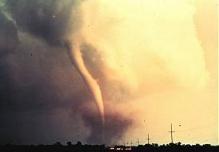
midwest during what is usually that area's tornado season.
During this orbit, GIFTS will also take measurements of the
cloud and radiation testbed, called CART, over Oklahoma. On
its second orbit GIFTS will measure storm activity over the
Pacific Ocean region along the West Coast.
GIFTS-IOMI
will fly geosynchronously 22,000 miles above Earth, allowing
it to always "stare" at our planet's surface. Flying
in such an orbit, GIFTS will have the capability of peering
through many layers of atmosphere and observing large regions
of our planet for extended periods of time. These capabilities
enable the observance of weather pattern formation distinct
advantages over current geostationary weather satellites that
"see" only small regions at a time.
Overview | A Joint Mission | The GIFTS Instrument | Instrument Technology Facts
|