Teachable Moments | May 2, 2022
How NASA Plans to Dig Up the Dirt on Climate Change
Learn about the role that dust plays in Earth's climate, why scientists are interested in studying dust from space, and how to engage students in the science with STEM resources from JPL.
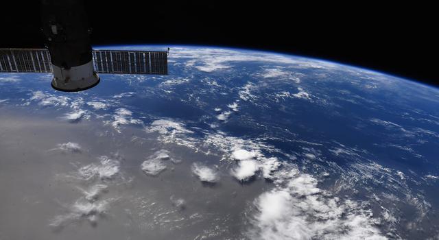
A NASA instrument launched to the International Space Station this summer will explore how dust impacts global temperatures, cloud formation, and the health of our oceans. The Earth Surface Mineral Dust Source Investigation, or EMIT, is the first instrument of its kind, designed to collect measurements from space of some of the most arid regions on Earth to understand the composition of soils that generate dust and the larger role dust plays in climate change.
Read on to find out how the instrument works and why scientists are hoping to learn more about the composition of dust. Then, explore how to bring the science into your classroom with related climate lessons that bridge physical sciences with engineering practices.
Why It’s Important
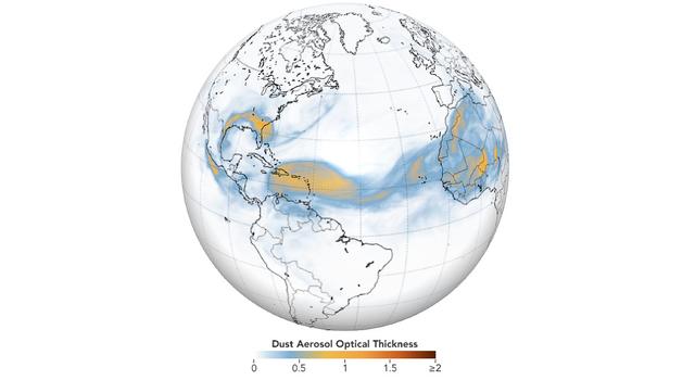
Scientists have long studied the movements of dust. The fact that dust storms can carry tiny particles great distances was reported in the scientific literature nearly two centuries ago by none other than Charles Darwin as he sailed across the Atlantic on the HMS Beagle. What still remains a mystery all these years later is what that dust is made of, how it moves, and how that affects the health of our planet.
For example, we now know that dust deposited on snow speeds up snow melt even more than increased air temperature. That is to say, that dust traveling to cold places can cause increased snow melt.
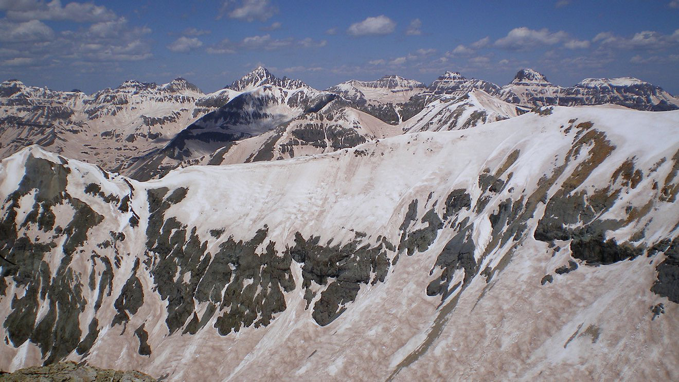
A coating of dust on snow speeds the pace of snowmelt in the spring. Credit: NASA | + Expand image
Dust can affect air temperatures as well. For example, dust with more iron absorbs light and can cause the air to warm, while dust with less iron reflects light and is responsible for local cooling. Iron in dust can also act as a fertilizer for plankton in oceans, supplying them with nutrients needed for growth and reproduction.

A plume of dust is shown emanating from over Alaska's Copper River in October 2016 in these images captured by the Moderate Resolution Imaging Spectroradiometer, or MODIS, instrument on NASA’s Terra and Aqua satellites. Dust storms play a key role in fueling phytoplankton blooms by delivering iron to the Gulf of Alaska. Credit: NASA | › Full image and caption
Floating dust potentially alters the composition of clouds and how quickly or slowly they form, which can ultimately impact weather patterns, including the formation of hurricanes. That’s because clouds need particles to act as seeds around which droplets of moisture in the atmosphere can form. This process of coalescing water particles, called nucleation, is one factor in how clouds form.
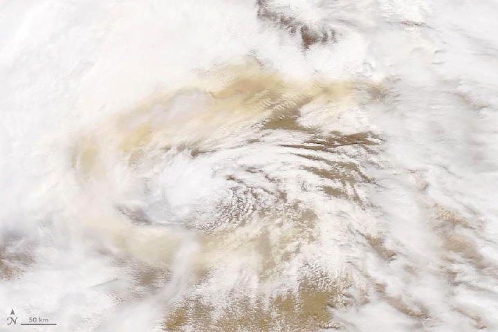
A swirl of dust mixes with the clouds in a low-pressure storm over the Gobi desert between Mongolia and China. This image was captured by the MODIS instrument on the Terra satellite in May 2019. Credit: NASA | › Full image and caption
Thanks to EMIT, we’ll take the first steps in understanding how the movements of dust particles contribute to local and global changes in climate by producing “mineral maps”. These mineral maps will reveal differences in the chemical makeup of dust, providing essential information to help us model the way dust can transform Earth’s climate.
› Learn more about what EMIT will do from JPL News
How It Works
NASA has been exploring how dust moves across the globe by combining on-the-ground field studies with cutting-edge technology.
Dr. Olga Kalashnikova, an aerosol scientist at NASA's Jet Propulsion Laboratory and a co-investigator for EMIT, has been using satellite data to study atmospheric mineral dust for many years, including tracking the movements of dust and investigating trends in the frequency of dust storms.
As Dr. Kalashnikova describes, “From the ground, we can see what types of dusts are lifted into the atmosphere by dust storms on a local scale, but with EMIT, we can understand how they differ and where they originally came from.”
EMIT is the first instrument designed to observe a key part of the mineral dust cycle from space, allowing scientists to track different dust compositions on a global scale, instead of in just one region at a time. To understand dust’s impact on Earth’s climate, scientists will use EMIT to answer key questions, including:
- How does dust uplifted in the atmosphere alter global temperatures?
- What role do dusts play in fertilizing our oceans when they are deposited?
- How do dust particles in the atmosphere affect cloud nucleation; the process by which clouds are ‘seeded’ and begin to coalesce into larger clouds?

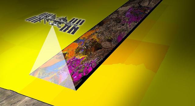
The EMIT instrument will fly aboard the International Space Station, which orbits Earth about once every 90 minutes, completing about 16 orbits per day. Credit: NASA | + Expand image
To achieve its objectives, EMIT will spend 12 months collecting what are called “hyperspectral images” of some of the most arid regions of our planet selected by scientists and engineers as areas of high dust mobility, such as Northern Africa, the Middle East, and the American Southwest.
These images are measurements of light reflected from the Earth below, calibrated to the distinct patterns, or spectra, of light we see when certain minerals are present. The EMIT team has identified 10 minerals that are most common, including gypsum, hematite, and kaolinite.
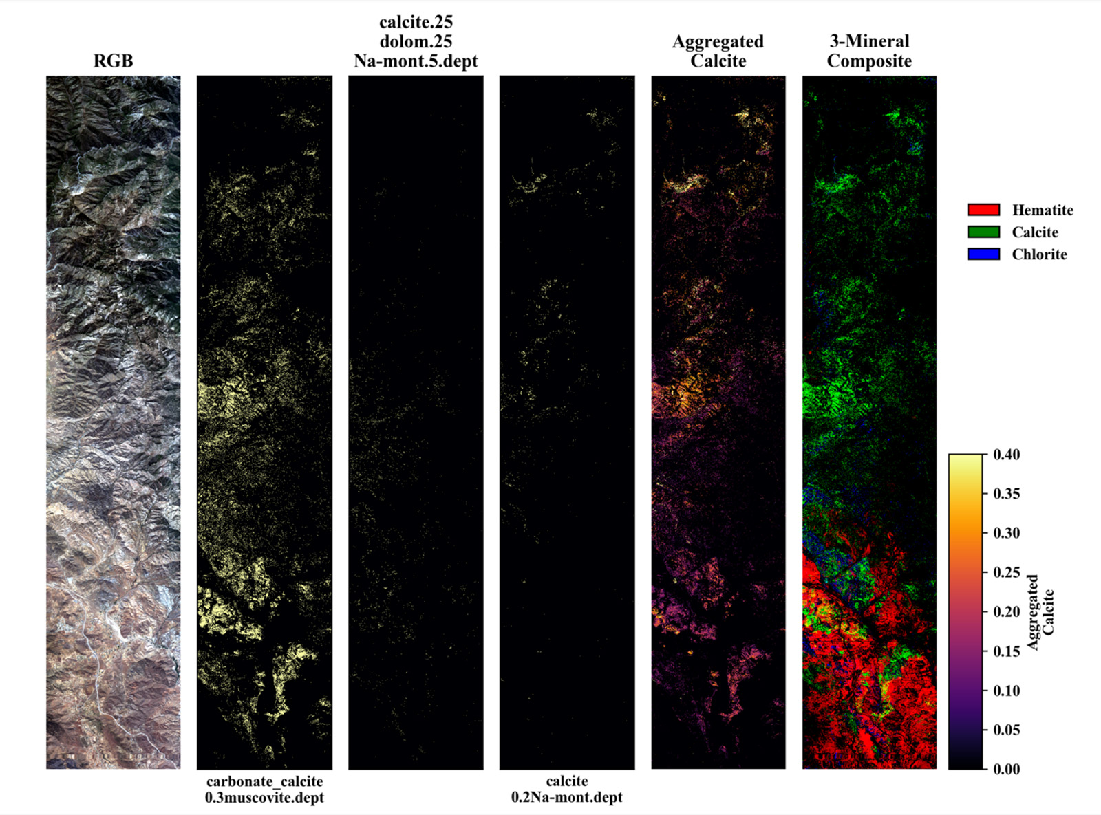
This example spectra shows how scientists will be able to identify different concentrations of minerals and elements in data collected by EMIT. Credit: NASA/JPL-Caltech | + Expand image
Why are these minerals important? One key reason is the presence or absence of the element iron, found in some minerals but not others.
Dr. Bethany Ehlmann is a planetary scientist and co-investigator for the EMIT project at Caltech and explains that when it comes to heating, “a little bit of iron goes a long way.” Iron in minerals absorbs visible and infrared light, meaning that even if only a small amount is present, it will result in a much warmer dust particle. Large amounts of warm dust in our atmosphere may have an impact on temperatures globally since those dust particles radiate heat as they travel, sometimes as far as across oceans!
Collecting images from space is, of course, no easy task, especially when trying to look only at the ground below. Yet it does allow scientists to get a global picture that's not possible to capture from the ground. Field studies allow us to take individual samples from tiny places of interest, but from space, we can scan the entire planet in remote places where no scientist can visit.
Of course, there are some complications in trying to study the light reflected off the surface of Earth, such as interference from clouds. To prevent this problem, the EMIT team plans to collect data at each location several times to ensure that the images aren’t being obscured by clouds between the instrument and the minerals we’re looking for.
The data collected by EMIT will provide a map of the compositions of dust from dry, desert environments all over the world, but the team involved won’t stop there. Knowing more about what the dust is made of sets the stage for a broader understanding of a few more of the complex processes that make up our global climate cycle. Upon completion of this study, EMIT's mineral maps will support further campaigns to complete our global dust picture. For example, NASA hopes to couple the data from EMIT with targeted field campaigns, in which scientists can collect wind-blown dust from the ground to learn more about where dust particles move over time and answer questions about what types of dust are on the go.
Furthermore, missions such as the Multiangle Imager for Aerosols, or MAIA, will allow us to better understand the effects of these dust particles on air-quality and public health.
Teach it
Studying Earth’s climate is a complex puzzle, consisting of many trackable features. These can range from sea level to particles in our atmosphere, but each makes a contribution to measuring the health of our planet. Bring EMIT and NASA Earth Science into your classroom with these lessons, articles, and activities to better understand how we’re exploring climate change.
Educator Guides
-
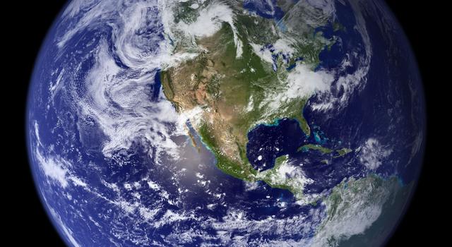
Ocean World: Earth Globe Toss Game
Students use NASA images and a hands-on activity to compare the amounts of land and surface water on our planet.
Subject Science
Grades K-6
Time Less than 30 mins
-
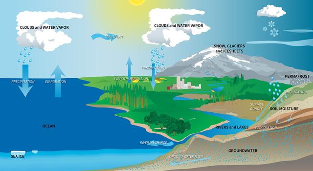
Modeling the Water Budget
Students use a spreadsheet model to understand droughts and the movement of water in the water cycle.
Subject Science
Grades 5-8
Time 30-60 mins
-
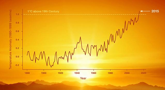
Graphing Global Temperature Trends
Students use global temperature data to create models and compare short-term trends to long-term trends.
Subject Math
Grades 5-12
Time 1-2 hrs
-
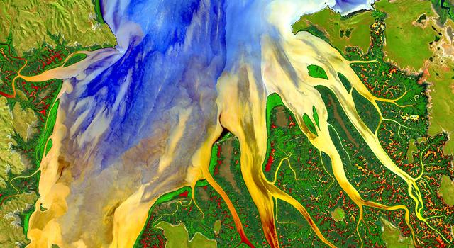
Using Light to Study Planets
Students build a spectrometer using basic materials as a model for how NASA uses spectroscopy to determine the nature of elements found on Earth and other planets.
Subject Science
Grades 6-11
Time > 2 hrs
-

Cloud Computing: A 'Pi in the Sky' Math Challenge
In this illustrated math problem, students use pi to calculate how much water could be contained within a cloud.
Subject Math
Grades 6-12
Time Less than 30 mins
-
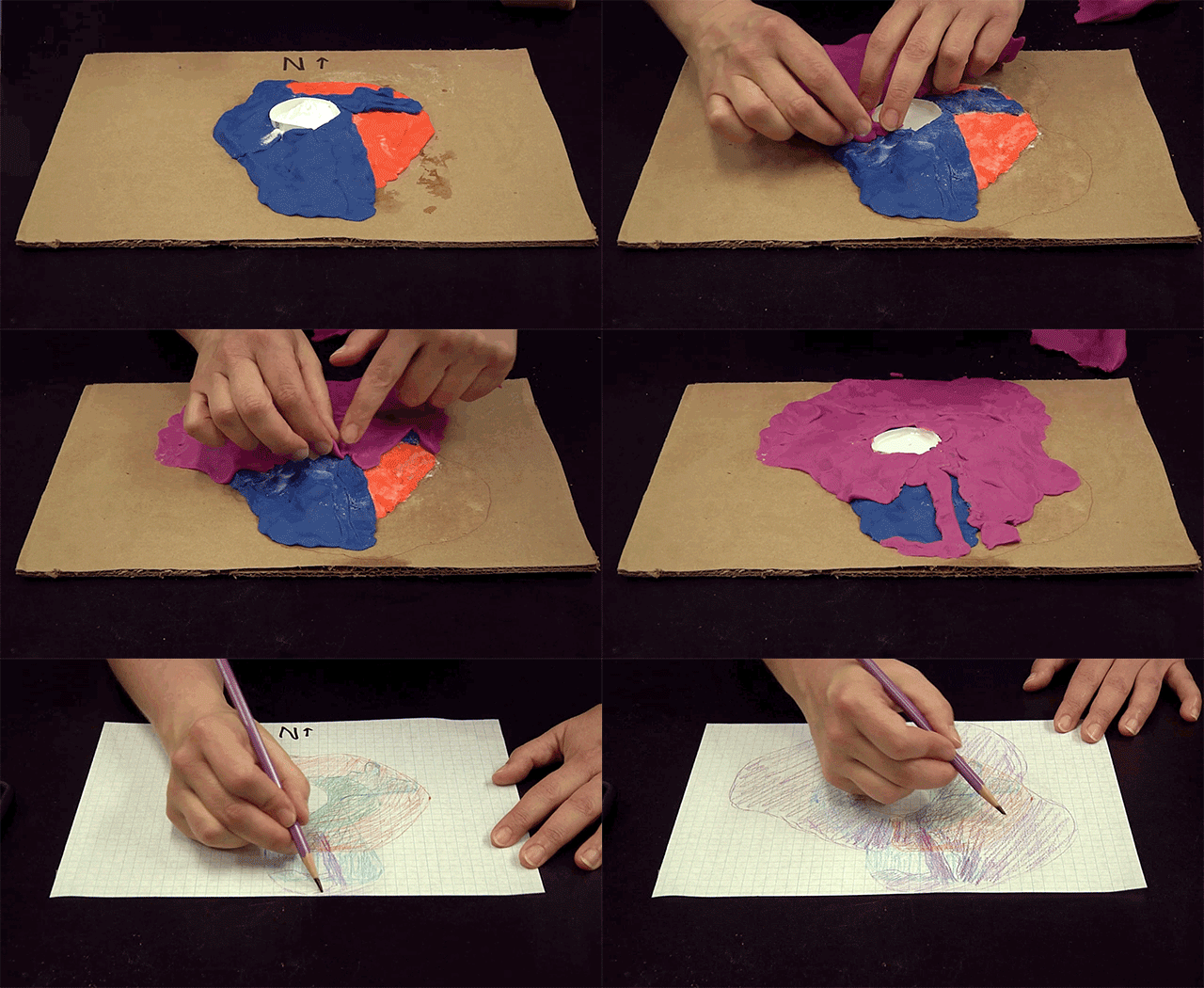
More Earth Science Lessons for Educators
Explore a collection of standards-aligned STEM lessons for students that get them investigating Earth science along with NASA.
Student Activities
-

The Types of Clouds and What They Mean
Learn about cloud types and how they form. Then help NASA scientists studying clouds.
Subject Science
Grades K-3
Time 30-60 mins
-

Make a Cloud in a Bottle
Have you ever wondered how clouds form? In this activity, you can make your own cloud to see for yourself!
Subject Science
Grades 4-12
Time < 30 mins
-
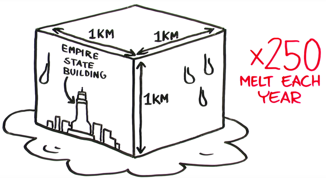
Video Series: NASA's Earth Minute
Learn about the science behind climate change and the NASA missions studying it in these short videos.
Subject Science
Grades 2-12
Time < 30 mins
-
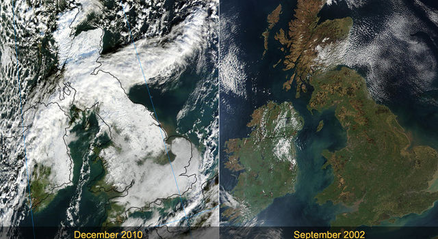
The Change of Seasons: Views from Space
See how seasonal changes affect our planet.
Subject Science
Grades 2-12
Time < 30 mins
-

More Earth Science Activities for Students
Explore Earth science with these projects, videos, and slideshows for students.
Articles
-
 Teachable Moments
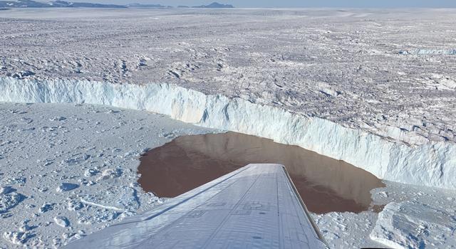
Reflecting On Greenland’s Melting Glaciers as OMG Mission Concludes
Explore how the OMG mission discovered more about what's behind one of the largest contributors to global sea level rise.
-
 Teachable Moments
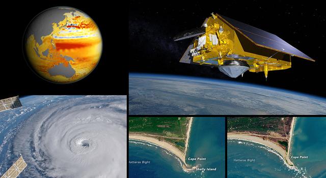
Earth Satellite Joins NASA Fleet to Monitor Sea Level, Improve Weather Forecasts
Learn about the mission and find out how to make classroom connections to NASA Earth science – plus explore related teaching and learning resources.
-
 Teachable Moments
Climate Change Collection
Explore this collection of Teachable Moments articles to get a primer on the latest NASA Earth science missions, plus find related education resources you can deploy right away!
Websites
- NASA Climate Change
- NASA Earth Observatory - Images of Dust and Haze
- NASA Climate Kids
- Recursos En Español: NASA Climate Change
TAGS: Earth, climate, geology, weather, EMIT, Teachers, Classroom, Lessons, Earth Science, Climate Change, Dust, Global Warming, Educators, K-12, Teachable Moments, Climate TM


